Using remote monitoring to identify and resolve violations
Land trusts can use remote monitoring to check more frequently on known or potential issues.
For example, the accredited Prickly Pear Land Trust (MT) wanted to monitor a property for any violations after they denied a landowner’s request to create a road. They were able to save time and resources by comparing past and current imagery to see that there were no changes to the landscape.

Using historic images for violation timeframe
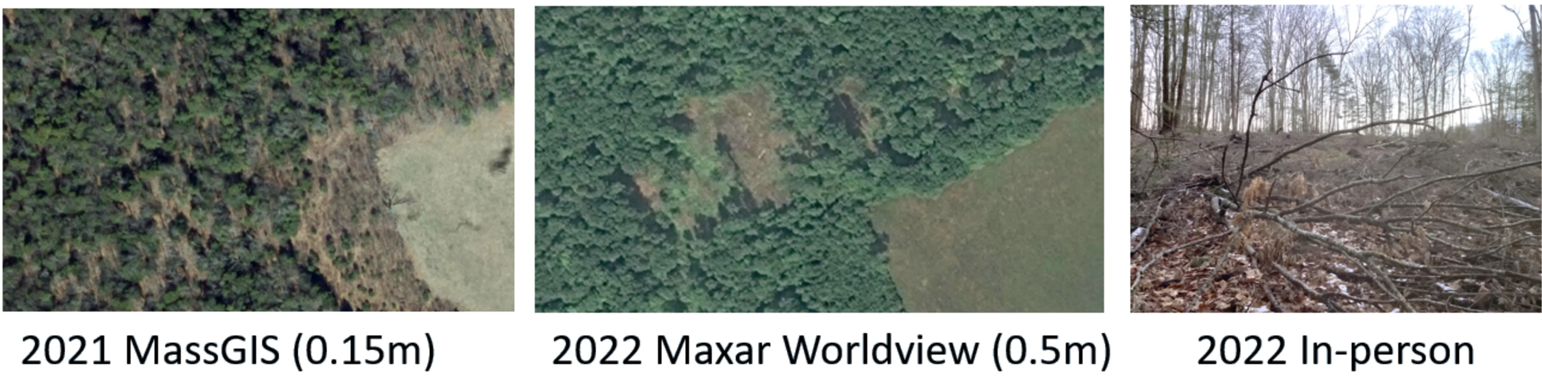
Land trusts are using historic aerial imagery to identify exactly when violations occur, as well as establish previous conditions of the property. Particularly in cases where the baseline documentation report may not have good photos of some areas of the property, historic imagery can be used to prove when a violation occurred and negotiate a resolution. This example shows the progress of an allowed timber harvest. Monitors were able to use the 2022 Satellite Maxar Worldview (.05m) image to ensure the correct stand was being harvested. The comparison to the 2021 MassGIS (0.15m) plane-flown older image shows the power of documenting changes on the landscape to monitor allowed activities and document violations.
Resolution of violations and issues
Land trusts are using aerial imagery to confirm violations to save time and resources that would be expended through a visit to the property. In the example below, The Nature Conservancy California identified beehives in a section of the easement that does not allow this activity. They worked with the landowner to move the beehive operation to another area and were then able to access satellite imagery to confirm a resolution of the violation without having to make another visit to the property.
