Using remote imagery in property inspection and baseline documentation
Using aerial imagery to inspect a property before acquisition or in baseline documentation reports can provide land trusts with several benefits. Practice Element 8C1 requires land trusts to visually inspect properties before buying or accepting donations of conservation land or conservation easements to determine and document whether there are important conservation values on the property and the project meets the land trust’s project-selection criteria. For remote or very large properties, a site inspection may involve an aerial flyover or a detailed visual analysis of satellite photos to supplement an in-person inspection.
Land trusts can also use remote imagery to create more accurate baseline documentation or current condition report or to update a baseline documentation report before closing. When selecting an image for a baseline, a land trust should ensure:
The date of the image is current so it reflects the condition of the land at the date of closing of the easement.
The spatial resolution produces enough detail to spot any subsequent changes.
The image quality is clear of clouds, smoke and snow. Note that if leaf-on imagery is used, the only change that can be detected is the presence or absence of trees.
Of course any baseline or current condition report, whether it includes remote imagery or not should follow guidance outlined in Practice 11B, and those land trusts seeking accreditation or re-accreditation must meet accreditation requirements.
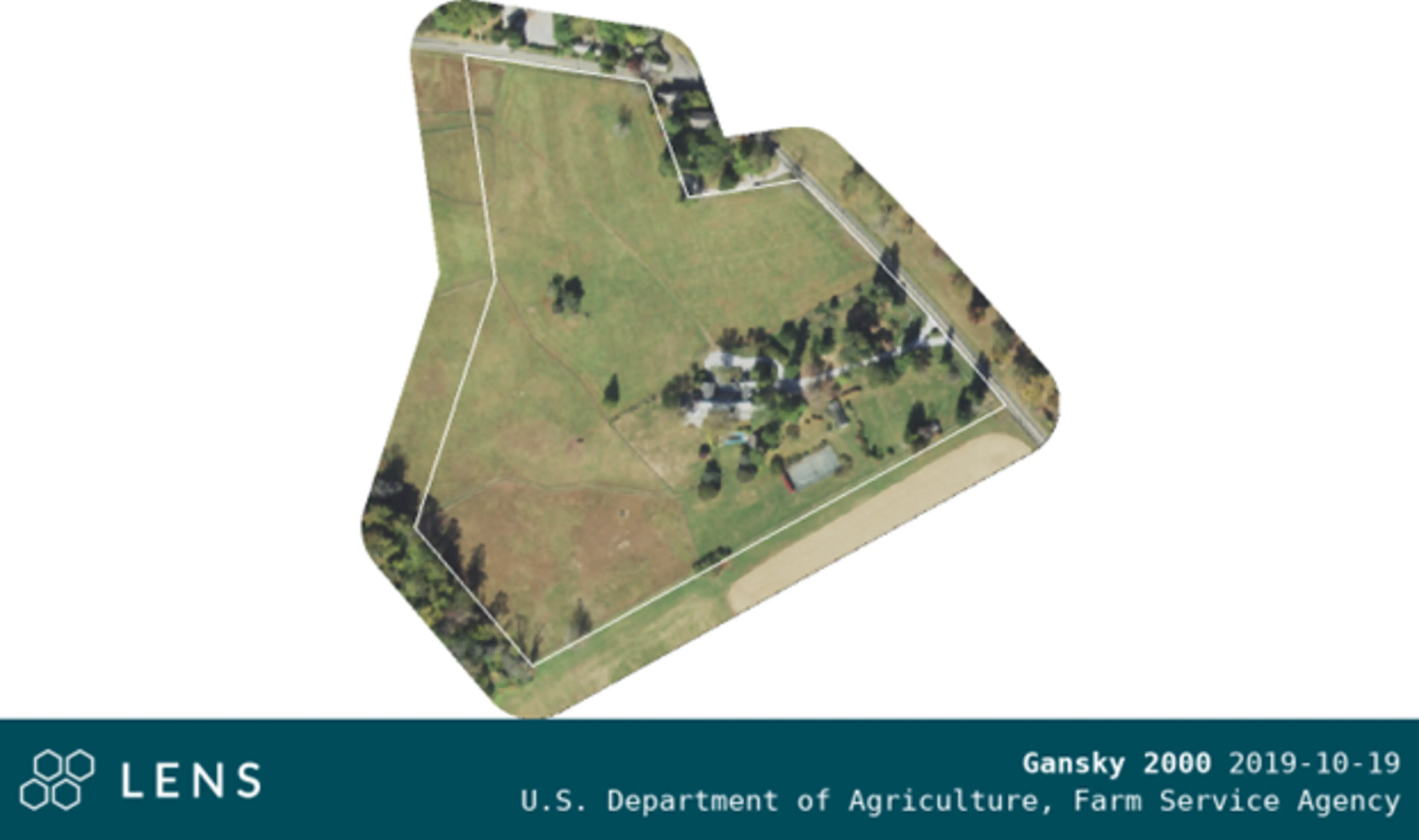
An example is shown above of an image that could be used as a baseline. Even though this image was taken during the growing season, the few trees that are visible do not obscure the structures and the field details are clearly shown.
Organizations can also add aerial imagery to update an older baseline before closing. They simply add that image, along with the date and time it was taken, to the baseline documentation report. Organizations considering this strategy should review whether the property is managed intensively or if it has been impacted by weather or other known changes. This strategy might not be suitable for easements where there are structures or any other feature located under the canopy documented in the baseline.
Aerial imagery is also used to update baseline documentation reports to be repurposed as current condition reports. Historic and current aerial imagery can be useful for understanding the changes that have occurred on a property.
“We are exploring ways to enhance our entire stewardship program. We would like to use it for baseline reporting and mapping, documenting streambank erosion, printing out imagery from different dates for in-person site visit with landowner and partners.”