Emerging technologies
This page touches upon more tools and techniques available as technology continues to grow and evolve.
Hyperspectral imagery
This imagery can contain anywhere from a few to hundreds of discrete light bands and is capable of identifying unique minerals, compounds, surface liquids, gases, pollutants, vegetation species and built materials. This technology is now publicly available for purchase—however, it may be some time before the pricing is affordable at the scale necessary for land trust work.

Digital twins for baseline conditions
A digital twin is a digital model of a real-world physical product, system or process. This approach uses LiDAR technology to create a 3D design-grade digital model of the built and natural features of a property. This tool can produce high-resolution terrain models when the LiDAR image is taken from a drone or plane. While this tool is currently used more frequently for mitigation projects, it may become the standard for conservation baselines as technology prices drop.

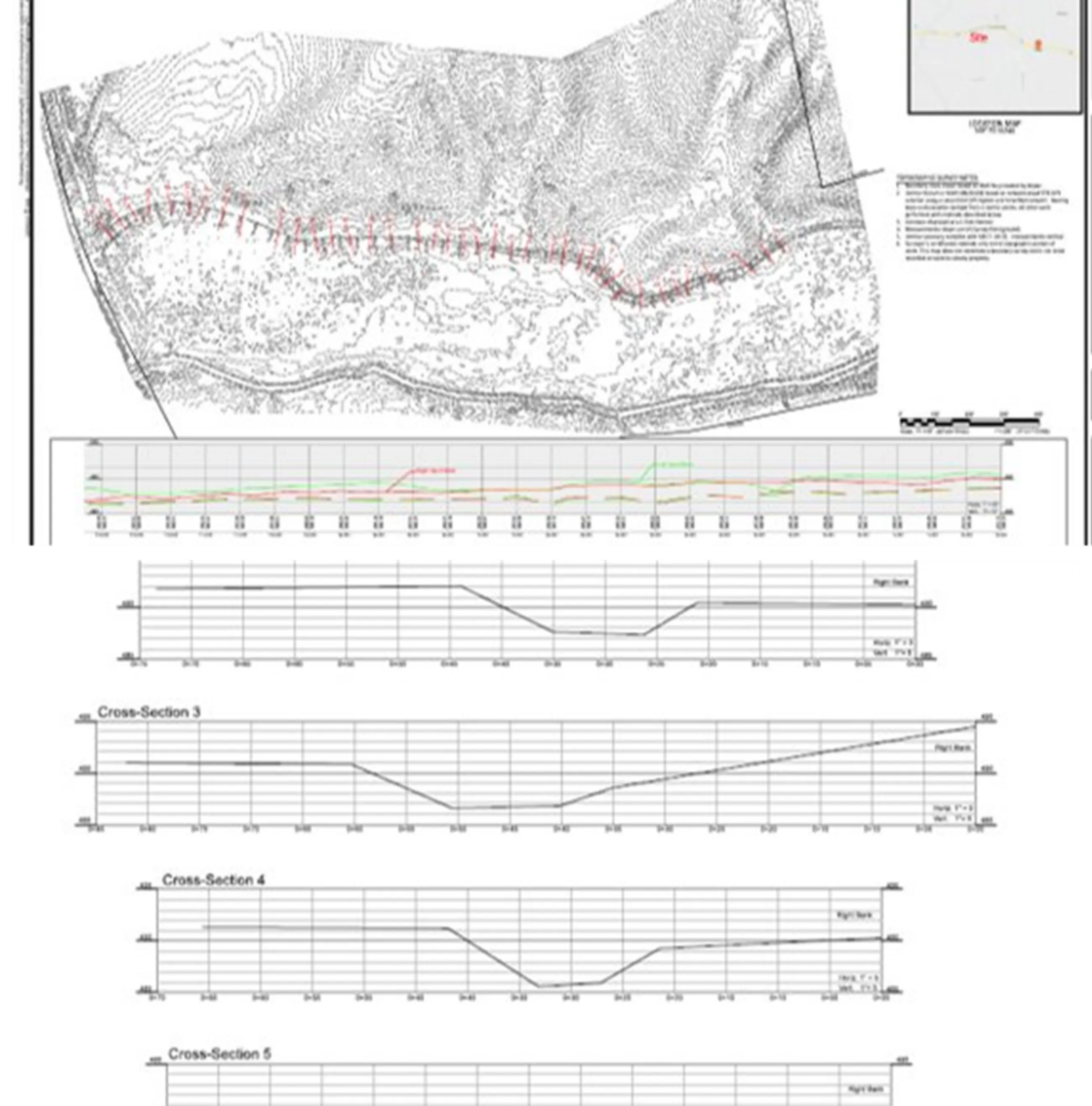
Design-grade baseline products
These products can produce an authoritative baseline condition property report by integrating the built environment with survey controls set by a professional land surveyor. This tool is created within GIS using an extension of CAD software (computer-aided design).
Machine learning advancements: tree counting
Imagine a computer that could count the number of trees based on drone imagery. The reality is here with machine learning. Shown below an image used by a trained tree canopy detector to count a total of 70,000 trees on a property. After drone (UAV) mapping is used to create a mosaic image of the property with at least 2cm resolution, the detector uses the mosaic image to count the number of trees.

Satellite stereo photogrammetry
This technique requires overlapping high-resolution satellite imagery to create an interactive 3D model that can be used to view an area from a variety of angles and resolutions. The resulting model can be used as a replacement for drone imagery. The benefit is that you are using imagery provided by a company, and you don’t need to learn how to set up and use your drone, take it out to the field, deploy it, keep up with maintenance, etc.