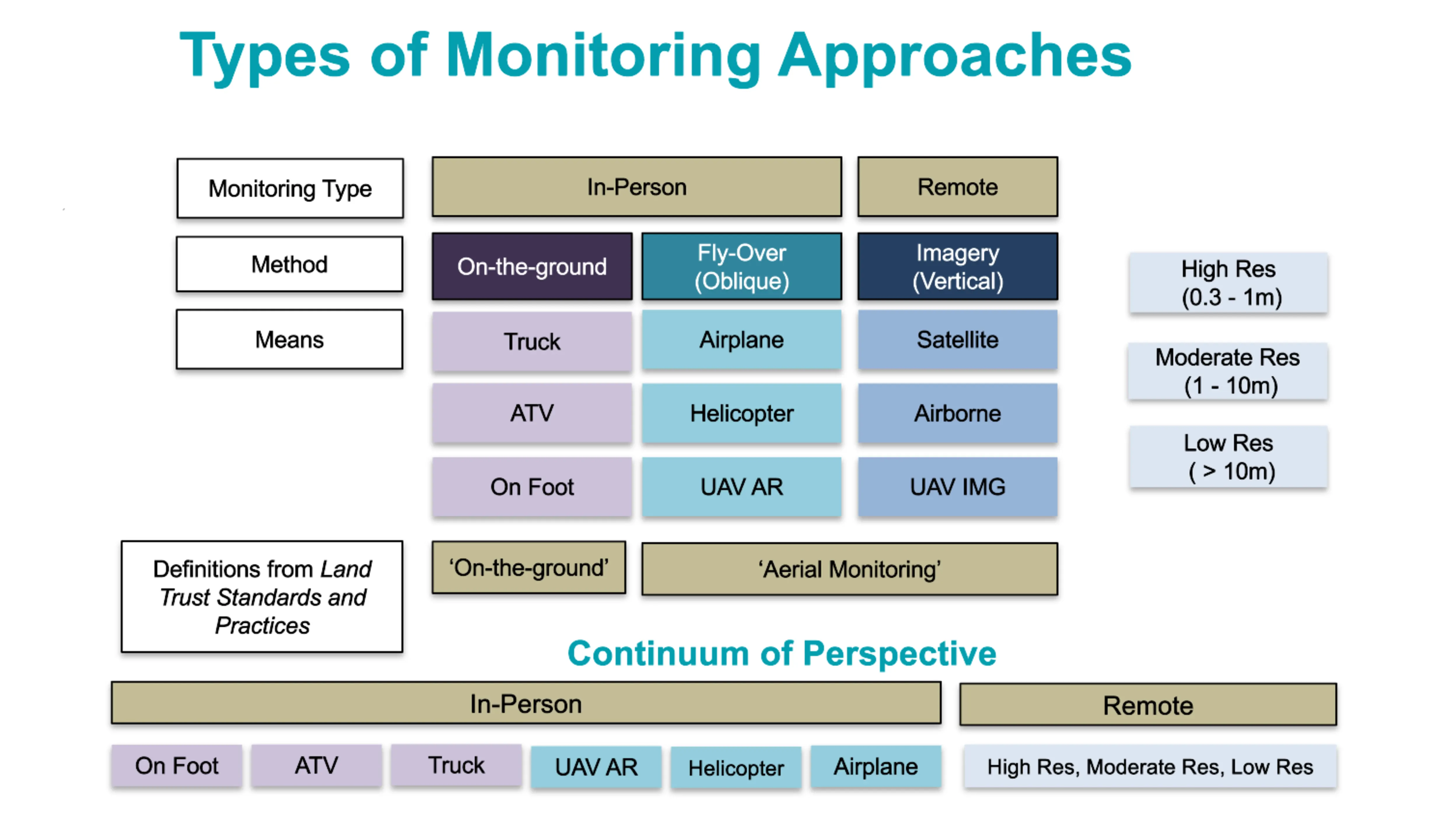
Types of remote monitoring
Almost as long as there have been land trusts in the United States, they have used aerial imagery.
Typically, this imagery was produced by aircraft: a staff or volunteer flying in a piloted plane or from a camera fixed on an aircraft. The expense varied – it could be free when pilots volunteered their time or made very expensive due to the cost of scheduling a specific flight path and the technical skills necessary to georeference captured images. The cost of the technology was outside of the budget for most organizations, so it was primarily land trusts with large portfolios (many land parcels with large acreage spread out across a region) that found this type of monitoring cost effective. These organizations, however, paved the way for other land trusts to learn from their experiences.
In 2015, the Department of Defense began allowing commercial satellite companies to sell their images immediately to consumers without a release delay, forever changing the market for aerial imagery. As more companies offer satellite imagery and more industries take advantage of its many uses, the associated costs of access have decreased. When industries such as residential solar siting and real estate request imagery in areas near conserved land, that imagery can then be resold to land trusts at a lower price. The change has given land trusts access to greater types of imagery from more sources.
The third source of aerial imagery comes from an unmanned aerial vehicle (UAV) or drone, which is a type of aircraft flown by an operator on the ground. Equipped with cameras and other devices to collect data, UAVs have increasingly become a part of a land trust’s remote imagery toolkit as they have moved beyond strictly military uses or children’s toys to provide high-resolution imagery of land.
Comparison of remote monitoring methods
With a wider variety of aerial or remote imagery, land trusts can be confused as to which tool works best in what situation. Click on each method below to see a summary of benefits and drawbacks.
Staff or volunteers can often join flights
Staff or volunteers can take photos from the plane
Historically, planes and helicopters have provided the highest or finest resolution (greater than 0.1m resolution) on a large scale
Does not require permission of the landowner to use in monitoring
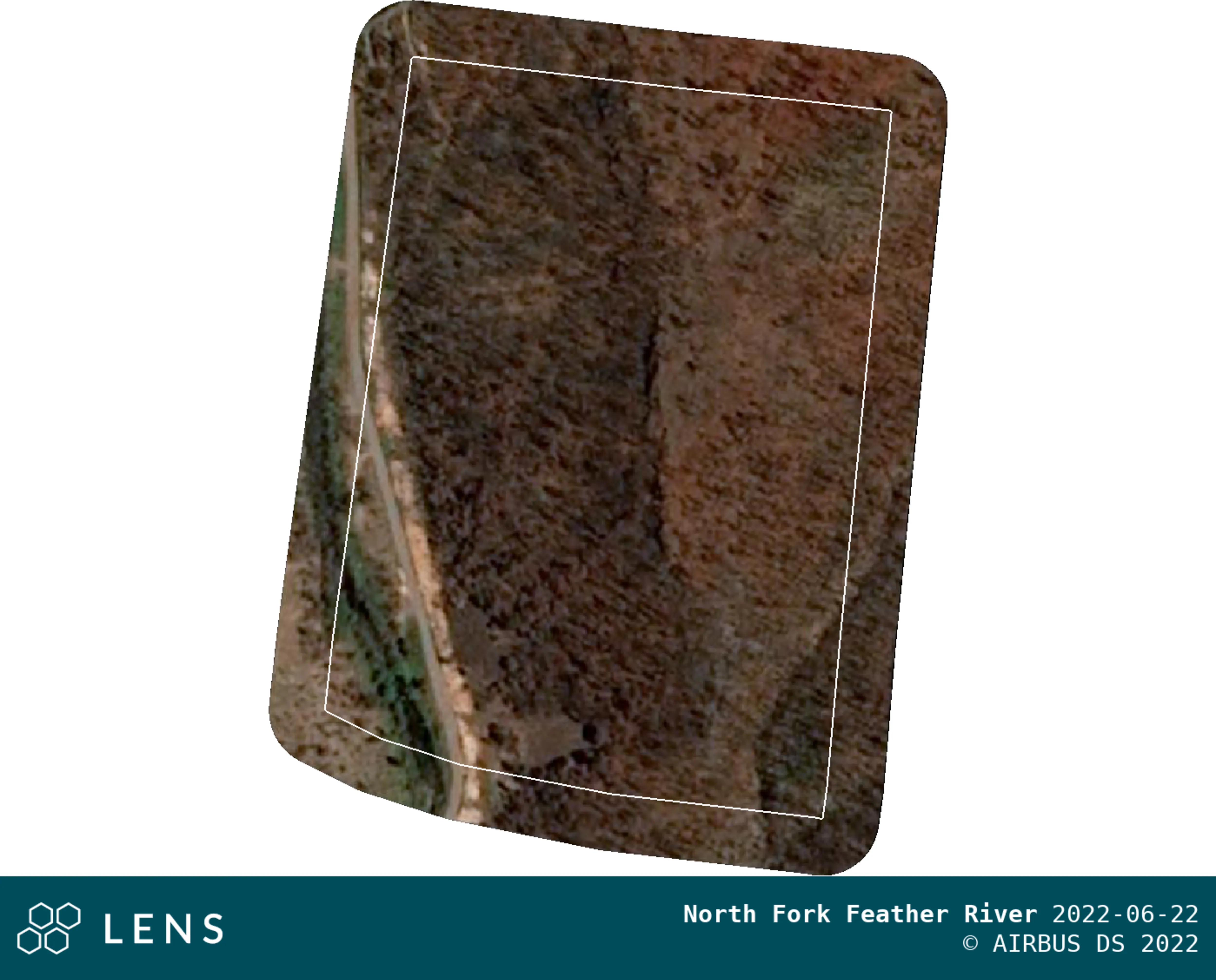
Photos taken might not be georeferenced and may need to have the boundaries of the property overlaid manually. See examples below.
Less cost effective when properties are spread over a large geographic area.

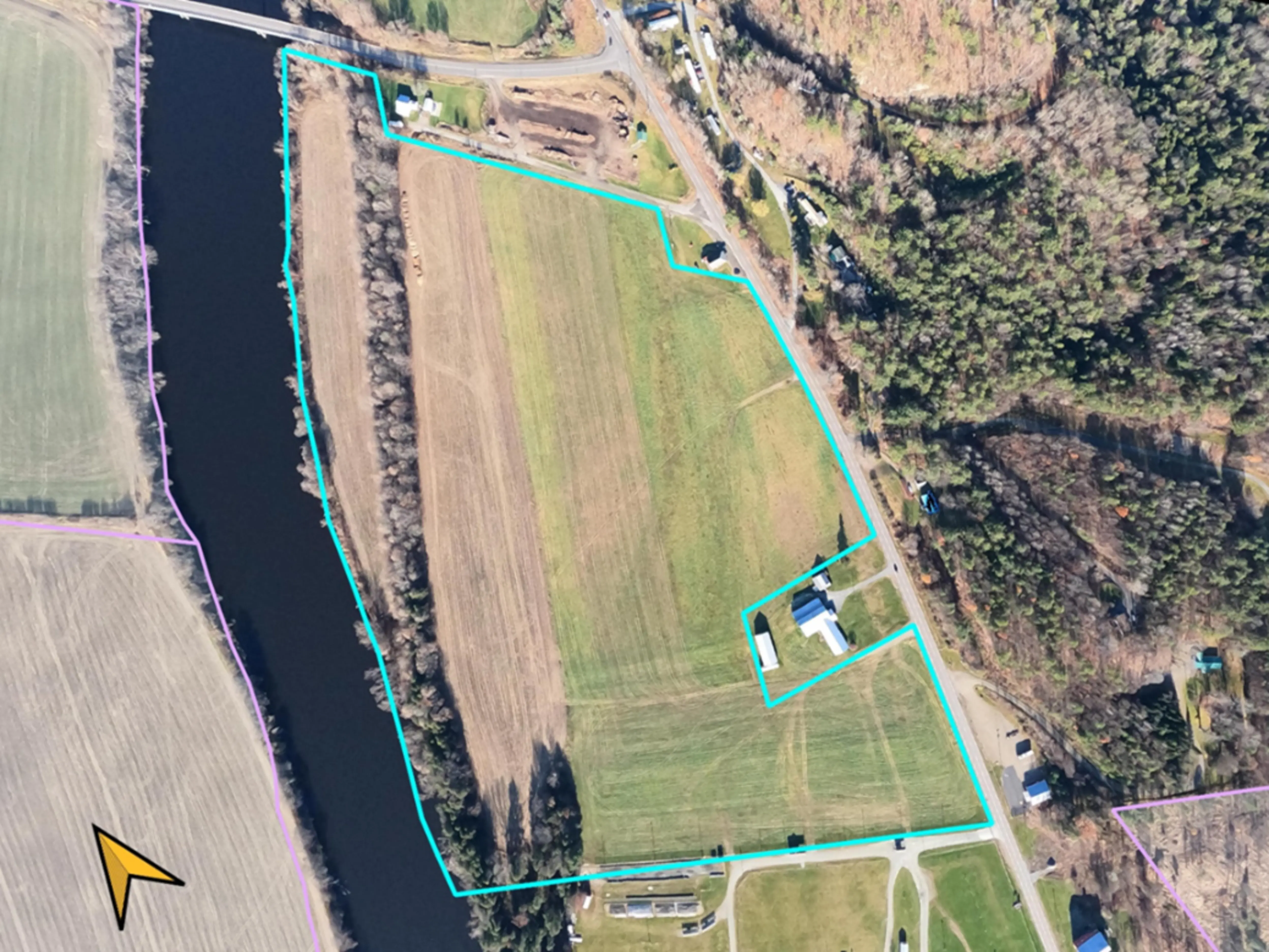
Common view from an airplane of a property, note the boundary here was hand drawn by the steward after the photo was taken from the plane.