Select an image source
Determine the best image type for your organization
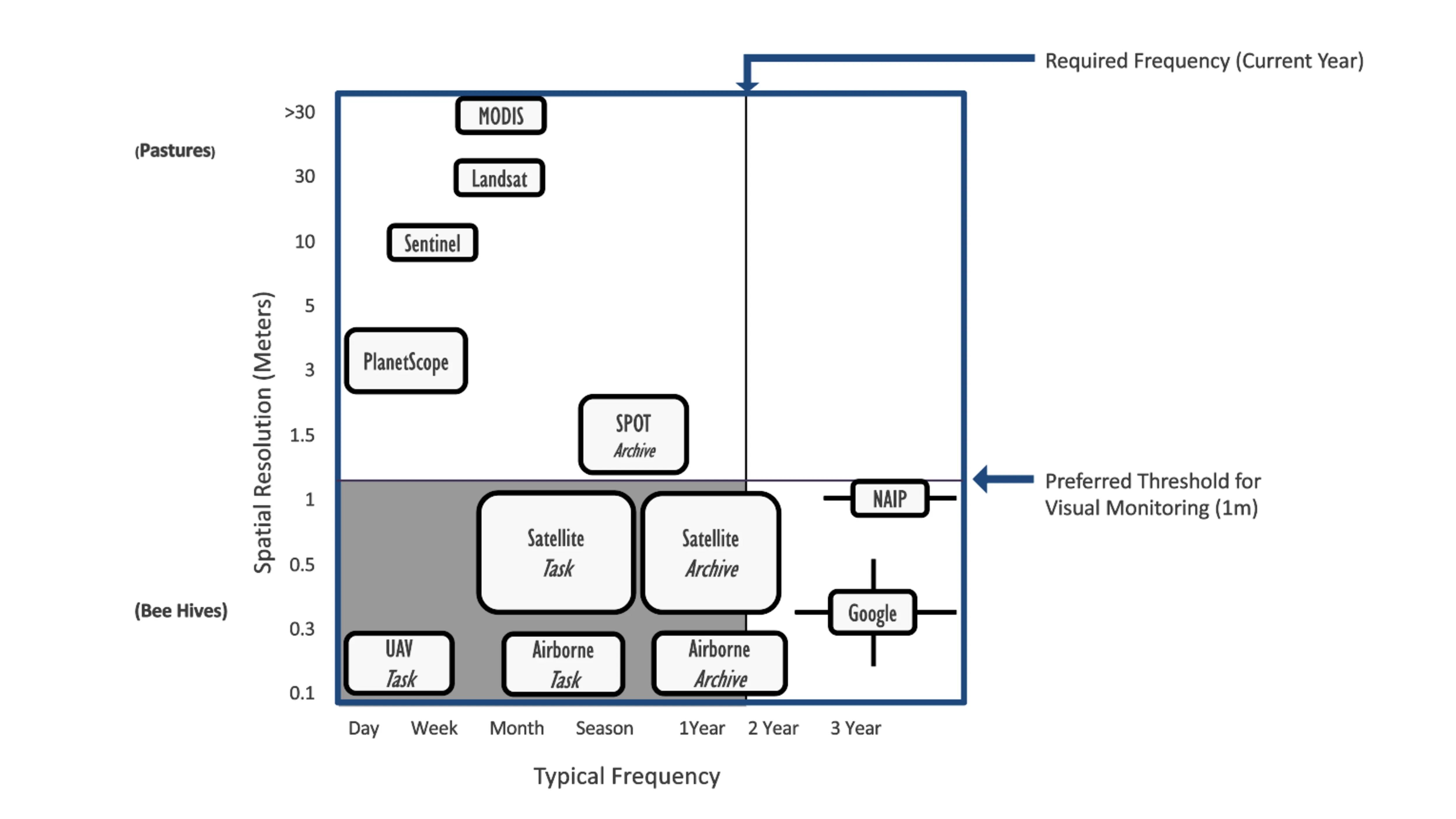
If starting with image source selection, determine what is the best image type for your organization and purposes. This decision will determine how much detail can be seen on the stewarded properties and what type of data can be collected. There are a variety of image sources available, and they can be used interchangeably and concurrently. Within those sources are factors that can impact that decision including understanding spatial resolution, spectral resolution, temporal resolution and geographic availability.
Satellite imagery has a range of spatial and spectral resolutions that can satisfy many monitoring requirements. The spatial resolution can range from 0.15m, a fine resolution capable of identifying objects as small as beehives or cattle, to 30m, a coarse resolution capable of seeing regional changes across towns and counties. Spectral resolutions are determined by the number of sensors on the satellites capturing the images, which can range from vegetation indexes to LiDAR and infrared. Temporal resolution can range from yearly to daily and geographic availability has greatly expanded. Land trust must consider the best conditions for imagery for their region, including snow cover, leaf-on, leaf-off and wildfire smoke impacts.
Aerial imagery can have a range of spatial resolution from .15m to 1m. While it is typically simple true color imagery, it can have some types of spectral imagery such as LiDAR or vegetation indexes. Temporal resolution and geographic availability are impacted by the date and area chosen to fly that can be determined by seasonal and weather conditions.
Drone imagery can have a range of spatial resolution from .01 to 1m, depending on the height of the drone and the capacity of the camera. Drone imagery has the advantage of being able to create orthomosaics with software assistance. Like satellite imagery, drone imagery is, typically, simple true color imagery but specialized drones can have some types of spectral imagery like LiDAR or vegetation indexes.