Ecological monitoring and restoration
Land trusts have found that remote imagery can help show the impact of management activity on the landscape.
Invasive species
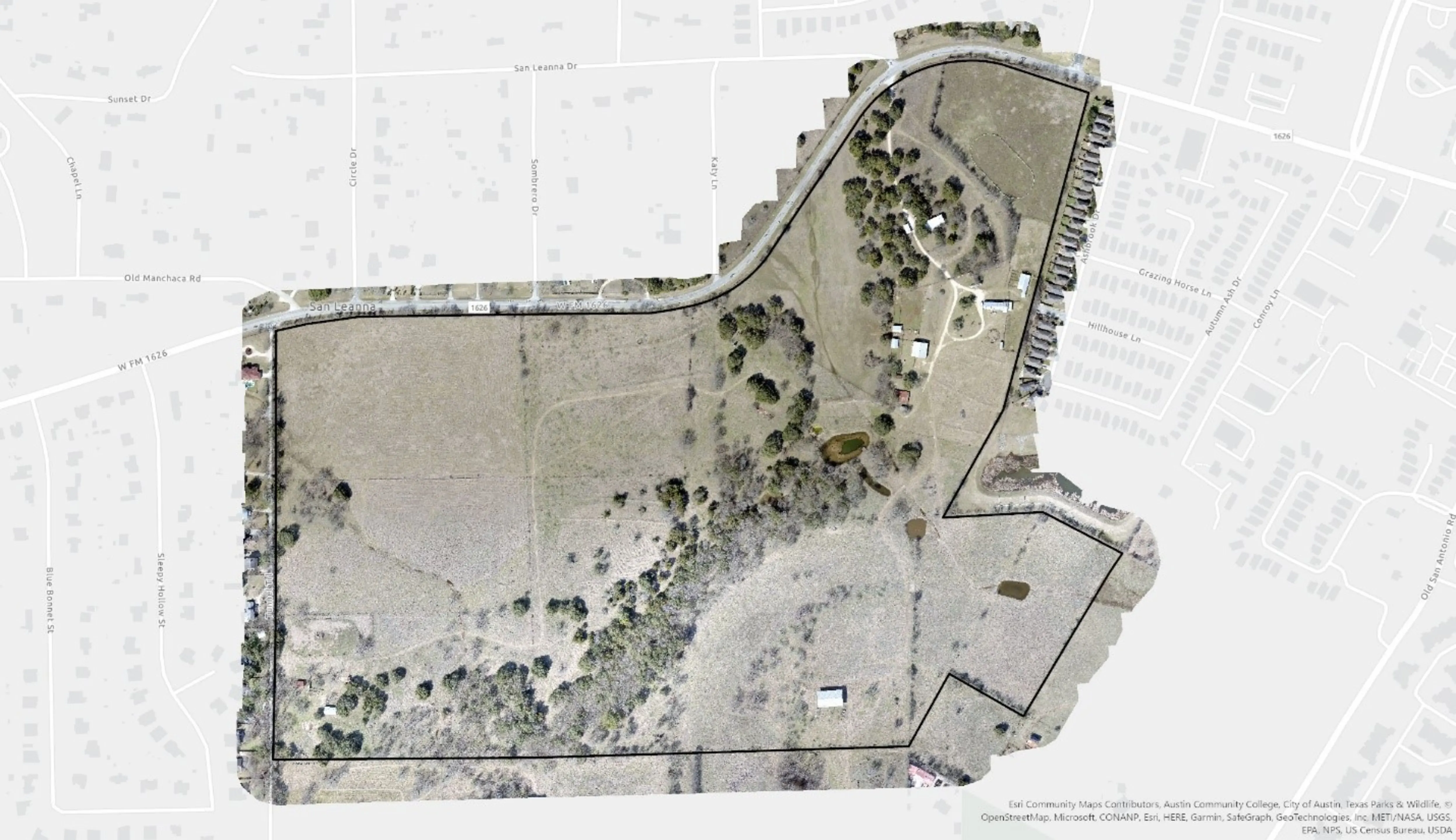
For restoration projects, land trusts have used UAVs to establish the current condition of the property as well as to document progress on past projects. The orthorectified image below, taken by drone, was produced by a land trust prior to invasive species management.
Stream restoration
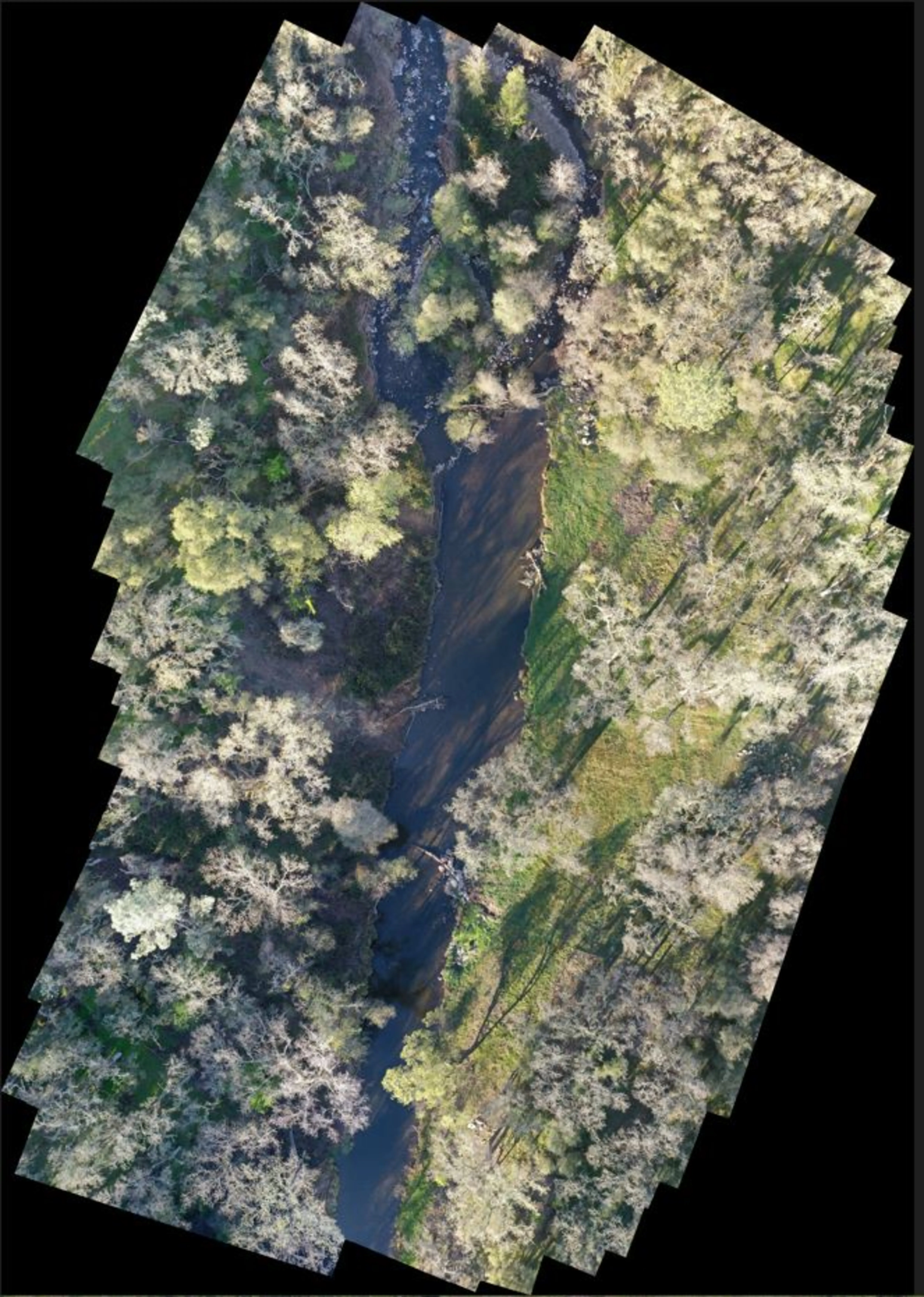
"We used drones to make an orthoimage of the restoration site. We hope to see sediment deposition in the floodplain in future imagery. Also, we partnered with a drone business out of Oregon, to use multi-spectral imagery to find possible salmon spawning sites, monitor creek bank health, perform vegetation surveys."
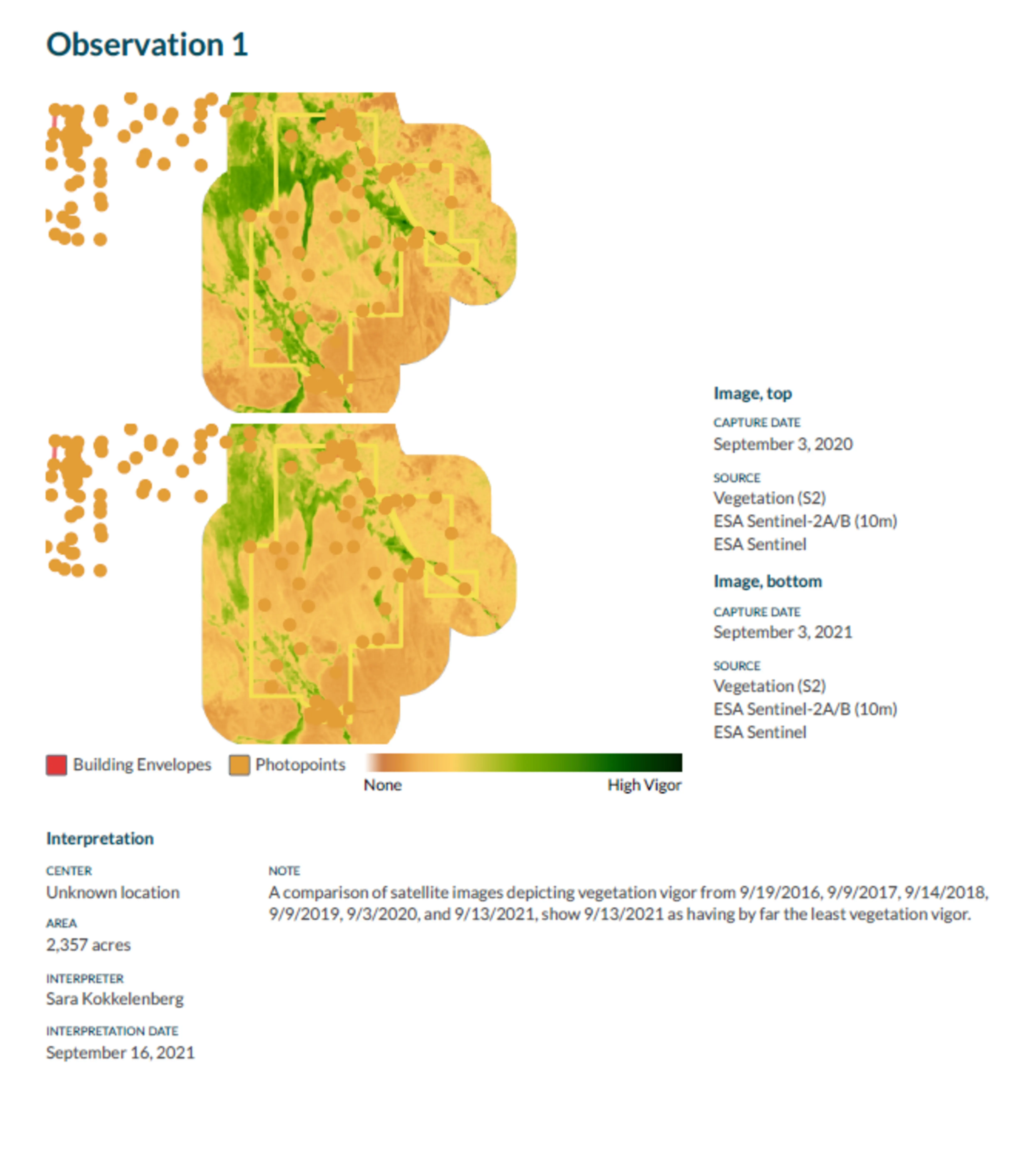
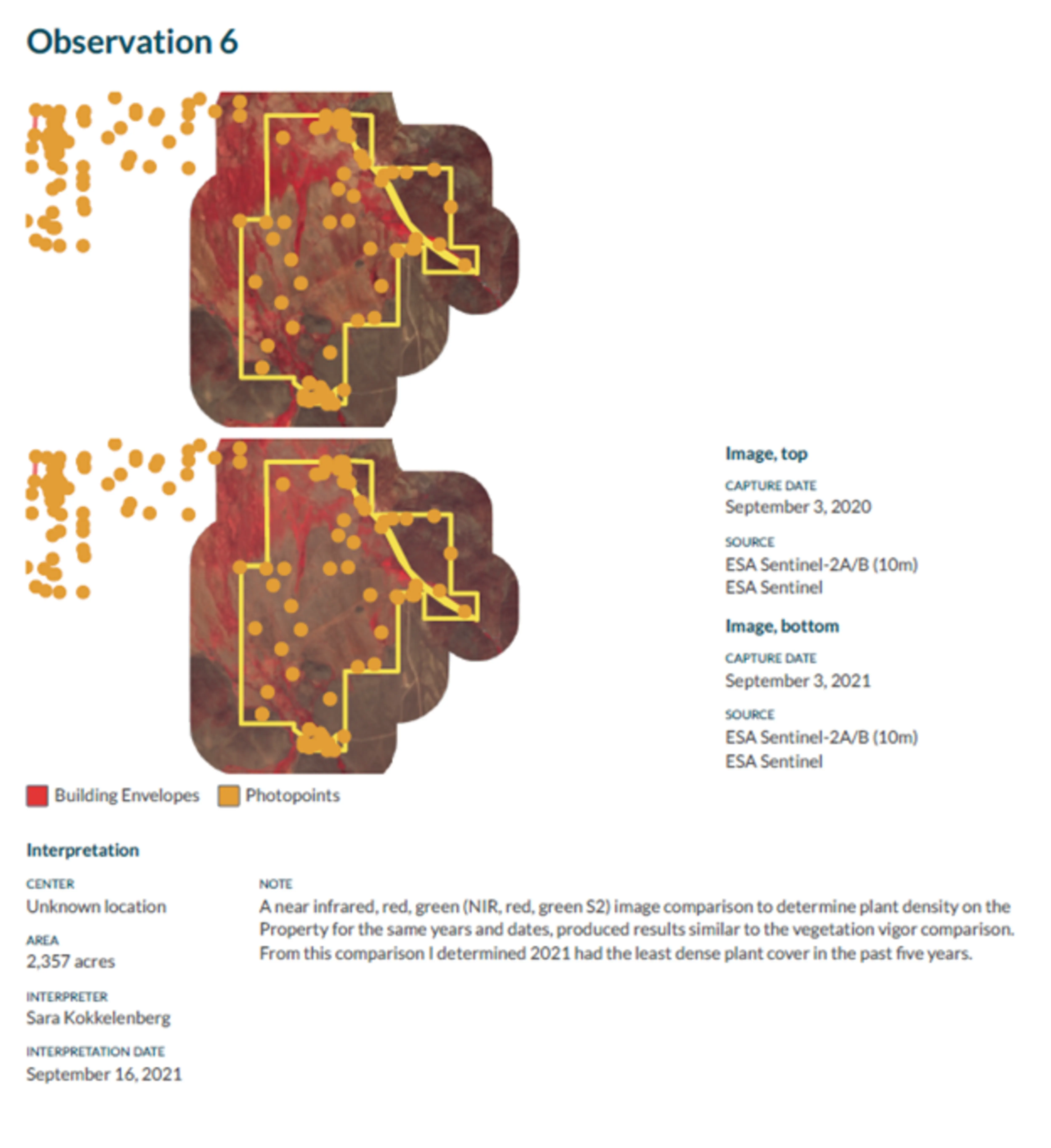
Stream restoration
The property shown here went through a restoration years before the land trust gained access to remote imagery. The land trust was able to access USDA NAIP (1m) imagery from summer of 2009, prior to the restoration, and compare that to summer of 2011, after the restoration. Through this imagery, the land trust was able to document changes to the stream channel, highlighted in the second image.
Grazing impacts
Infrared imagery was helpful to show a landowner vegetation and plant density to demonstrate property was in drought so they could understand land health.
Land trusts have reported using remote imagery for a number of ecological monitoring projects:
We will continue using remote monitoring with preserve management—climate change, canopy coverages baselines, restoration projects, identify gaps for tree planting and clearing. When we take all of that into consideration, the cost seems more feasible.
—Willistown Conservation Trust (accredited, PA)
We use it for monitoring dam removal results and clear cutting results. We also used it to report to the board—it's self-explanatory.
—Foothills Conservancy of North Carolina (accredited)
We are thinking about irrigation issues and being able to provide these products to their agricultural partners to show the changes to the landscape in different water years. The impacts of drought and documentation of that to show which properties are more vulnerable. We are looking, also, for more resilient areas for drought protection as well.
—Jackson Hole Land Trust (accredited, WY)
Yes, we would like to continue to remote monitor and use it for other cases: we want to use the soil moisture index to identify potential climate refugia to target future acquisitions.
—Northern California Regional Land Trust (accredited)