Protecting the Coast In a Changing Climate: 12 Rivers Conservation Initiative Incorporates Coastal Resilience Into Planning

About This Document
In midcoast Maine, land trusts from the Kennebec River to the St. George River have formed a partnership to conserve a network of connected lands. The 12 Rivers Conservation Initiative works to accelerate conservation in the region and to ensure multiple human and wildlife benefits for generations to come. 12 Rivers consists of six land trusts: Boothbay Region Land Trust, Coastal Rivers Conservation Trust, Georges River Land Trust, Kennebec Estuary Land Trust, Maine Coast Heritage Trust and Midcoast Conservancy.
In midcoast Maine, land trusts from the Kennebec River to the St. George River have formed a partnership to conserve a network of connected lands. The 12 Rivers Conservation Initiative (12 Rivers) works to accelerate conservation in the region and to ensure multiple human and wildlife benefits for generations to come. 12 Rivers consists of six land trusts: Boothbay Region Land Trust, Coastal Rivers Conservation Trust, Georges River Land Trust, Kennebec Estuary Land Trust, Maine Coast Heritage Trust and Midcoast Conservancy. Recently, 12 Rivers has prioritized the protection of coastal zones, vital ecosystems that provide numerous benefits to the entire region of midcoast Maine. A 2016 grant from the Open Space Institute’s Resilient Landscapes Initiative Catalyst Program enabled 12 Rivers to incorporate regional climate data into its conservation planning. Using terrestrial climate resilience datasets from The Nature Conservancy, 12 Rivers members identified sites in midcoast Maine with characteristics necessary to support biodiversity and wildlife movement in a changing climate. This helped the group prioritize resilient parcels in its service area.
In 2018, Kennebec Estuary Land Trust received a grant from the Land Trust Alliance’s Land and Climate Program that allowed 12 Rivers to augment its planning work with newly available coastal climate change resilience data, with the help of technical assistance from the Open Space Institute. “These land trusts are composed of staff and volunteers who are very knowledgeable about midcoast Maine,” explained Carrie Kinne, executive director of the Kennebec Estuary Land Trust. “After looking at the terrestrial data, these people knew that we needed to incorporate coastal resilience data into our planning.” Steven Hufnagel, executive director of the Coastal Rivers Conservation Trust, noted: “Each of the six land trusts in 12 Rivers carry out conservation in coastal zones. We needed sea level rise and marsh migration maps to be able to plan for, and talk about, coastal resilience.”
Identifying a need to protect the changing coast

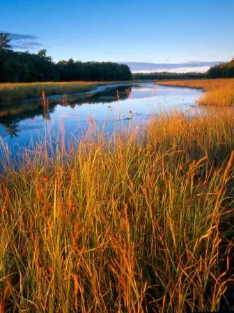
12 Rivers knew it was important to look more closely at the coastal zones. The members agreed on four major values to be considered in coastal zones when looking at climate data: salt marshes, intertidal mudflats (a key ecosystem for shellfish harvesting), sea level rise and access to the coast. Maine’s marshes and intertidal mud-flats are threatened by rising sea levels, and the state could lose more than half of its marshes if they have nowhere to migrate as sea level rises. Access to the coast allows people to enjoy these important areas and also supports two of Maine’s major economic industries: fishing and recreation.
12 Rivers started planning for protection of this changing coast with a map from the Maine Natural Areas Program that made it possible to incorporate a coastal buffer into resilience planning. Estimating a one-meter sea level rise, an approximately 300-meter area around the new coast was identified as a coastal buffer. This buffer would provide a protected area around new tidal marsh and mudflat habitat and allow for continued access to the changing coast. “By seeing this buffer on a map, we are able to envision which properties will be new coastal properties, and protect those,” stated Ruth Indrick, project coordinator for the Kennebec Estuary Land Trust.
Finding and using existing coastal resilience data
Indrick investigated the available coastal data and found three categories of data: First, current condition data that showed habitats along the coast. Second, future water and land data from the Maine Natural Areas Program showed the new coast at a one-meter sea level rise as well as marsh migration mapping. Third, the resilience modeling data from The Nature Conservancy was a key piece of the puzzle.

12 Rivers held several meetings to decide which available data would be most useful. The group ultimately decided to prioritize future water and land data, the resilience modeling data and any datasets that focused on human activities, such as the coastal buffers which predicted future coastal access for fishermen and recreationists. When asked what she would say to other groups looking at coastal resilience data, Indrick recommended deciding on shared values before looking at the datasets: “Those shared values made it easy to decide what data we did and didn’t need.”
Understanding different types of resilient lands
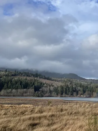
For the land trusts operating in the easternmost part of the region, the coastal resilience data proved especially helpful in communicating with landowners and partners. The terrestrial resilience mapping conducted in 2016 had highlighted the western, forested areas in the region. These areas included rocky hills, varying topographies and forested carbon sinks: all areas that are highly climate resilient. By adding another focus on coastal resilience, land trusts working on the coast, who had more open farmland and fewer forests and rocky hills, saw coastal areas light up on the map. “Suddenly these land trusts had the coastal resilience data,” said Annette Naegel, director of conservation at Georges River Land Trust, “which helped them talk about areas they already knew were important.” The data and maps provided staff and volunteers, whose on-the-ground expertise gave them an intrinsic understanding of the value of the land, with ways to communicate to landowners and external partners about why these lands were important to protect in the face of climate change.
New perspectives on coastal resilience help build municipal partnersips
12 Rivers isn’t the only group thinking about coastal resilience in midcoast Maine. “Town officials and local governments are starting to do some action planning around coastal resilience,” noted Nicholas Ullo, executive director of the Boothbay Region Land Trust. “With this data, we are playing a bigger role in those discussions.” Land trusts are finding that they can help towns prepare for climate change, supporting green infrastructure and smart planning for a changing coastline. At the table with municipalities and landowners, 12 Rivers members can offer resources and knowledge. “We ask: ‘Can we give you maps that would support planning? Can we conserve places that will help you prevent flooding, like marshes next to a busy road?’,” shared Jody Jones, executive director of the Midcoast Conservancy. “Having a land trust at the table can be helpful. These maps help us provide support and be at the table when decisions are being made.”
Lessons learned

12 Rivers Conservation Initiative
Location: Kennebec River to the St. George River in midcoast Maine
12 Rivers Conservation Initiative works to accelerate conservation of the forested landscape from the Kennebec River to the St. George River in midcoast Maine.
Of the 825,000 acres in the 12 Rivers Initiative area, approximately 45,000 acres are conserved.
12 Rivers Conservation Initiative partners include:
Take a look at the Georges River Land Trust’s webpage for the 12 Rivers Conservation Initiative.
This case study is presented by the Land Trust Climate Change Initiative, a partnership of the Land Trust Alliance and the Open Space Institute. Funding for this work is provided by the Jane’s Trust Foundation.