Projecting and Buffering Against Sea Level Rise Impacts
Source

About This Case Study
Land trusts can play a key role in framing conservation and community development dialogs in terms of sustainable stewardship and system-wide resiliency. By projecting sea level rise impacts and using GIS mapping to prioritize critical conservation areas, Scenic Hudson is spearheading efforts to ensure its landholdings will conserve ecologically significant processes and habitats.
© 2026 Land Trust Alliance, Inc. All rights reserved.
Disclaimer
These resources are provided "as is" for informational purposes only, without warranty of any kind. They do not constitute legal or professional advice and do not create an attorney-client relationship. They may not reflect current legal developments and should be adapted for your organization with qualified professional help. The Alliance is not liable for any damages arising from use of or reliance on these resources. Views in individual posts and third-party links/logos are not Alliance endorsements. The Alliance is committed to equal opportunity and does not condone unlawful discrimination.
For accreditation-related materials, please also consult the Land Trust Accreditation Commission website.
Value of the land and habitat
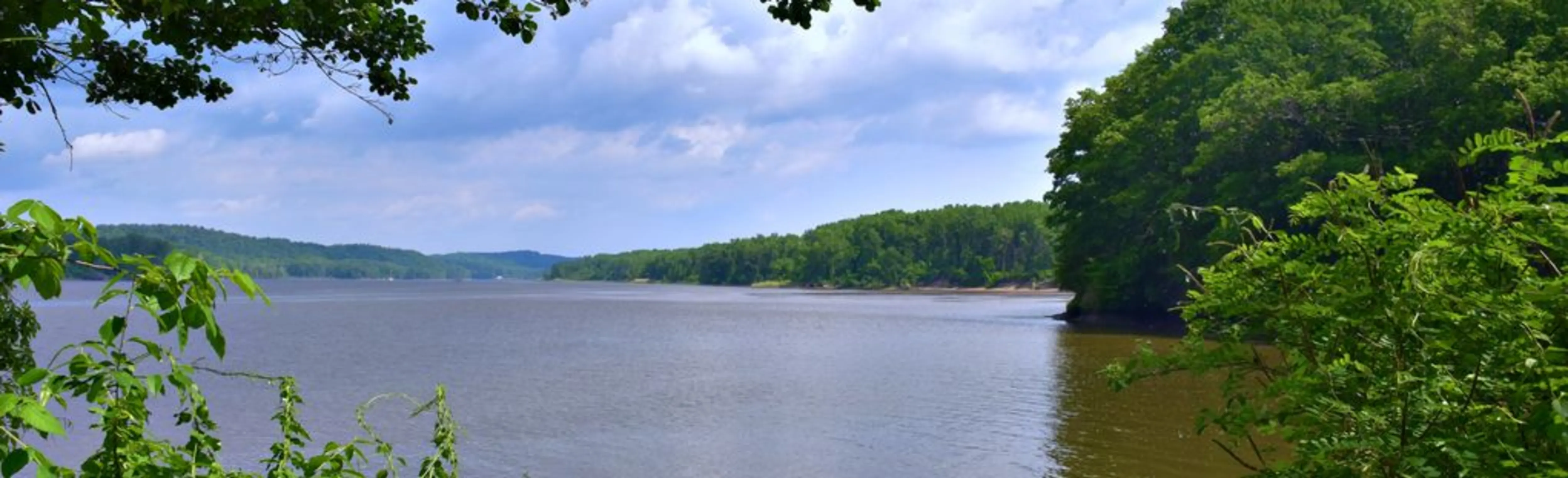
The Hudson River runs approximately 315 river miles, stretching from its source Henderson Lake, in Newcomb, New York, and flowing southward past Albany, between New York and New Jersey, until it empties in the Upper New York Bay which connects to the Atlantic Ocean. The lower half of the river is a tidal estuary, which occupies the Hudson Fjord. Fjords are geologically distinct narrow inlets with steep cliffs in a valley created by glacial activity.
The Hudson Fjord and its estuaries are important transitional zones between riverine and maritime environments. Additionally, the Hudson River provides an example of a semi-diurnal tidal system, experiencing two high tides and two low tides each day. This dynamic system provides nutrient-rich habitat with high biodiversity, resulting in one of the most significant estuarine habitats in the United States.
This ecosystem provides essential habitat to numerous species of fish, crustaceans, and invertebrates. For example, on the Little Newton Creek property, conserved shoreline, tidal flats, and upland areas provide habitat gradients that are critical to maintaining biological diversity. These ecosystems provide valuable feeding, resting, and nesting habitat for migratory waterfowl and marsh birds, and serves as an important nursery and feeding grounds for striped bass, shad, alewives, and herring. Additionally, the protected wetlands help to safeguard water quality. The purchase of the Little Newton Creek property exemplifies the continuing success of Scenic Hudson’s Save the Land That Matters Most campaign, which aims to protect 65,000 acres of great scenic, ecological, and agricultural significance throughout the Hudson River Valley.
Conservation concerns
The biologically rich landscape of the Hudson Valley is facing tremendous pressures from rapidly sprawling development, the spread of invasive species, and the loss of marsh ecosystems, challenges which are compounded by climate change impacts such as sea level rise. In response to these forces Scenic Hudson has increased the application of conservation science across all of it programs in order to protect habitats, biodiversity, and advocate for sustainable growth patterns in the Hudson River Valley.
Current protection status and management plan
Since 1963, Scenic Hudson has been working to protect and restore the natural landscapes in the Hudson Valley. The Scenic Hudson Land Trust has protected over 31,000 acres in nine counties and created or enhanced many parks and preserves for communities – several of which previously had little or no access to the river. Many of these projects were implemented in partnership with state and local government, other nonprofit organizations, and committed volunteers. TheSaving the Land that Matters Most campaign highlights Scenic Hudson’s approach to land conservation.
Additionally, the 2010 publication of Revitalizing Hudson Riverfronts, a 100-page illustrated guide, aims to help communities plan future growth in order to “promote the development of lively, pedestrian-friendly, mixed-use riverfronts in and adjacent to municipal centers while conserving forests, farms, wetlands, and fields, and providing for a continuous public greenway along the river.” The guide recommends comprehensive strategies to protect, restore, and rehabilitate fish and wildlife habitat while planning riverfront development, including:
These efforts to support comprehensive community planning throughout the region are driven by the belief that strategic land use planning will allow riverfront communities to accommodate and benefit from new development in ways that increase economic viability, enhancing main streets and community life while protecting the Hudson River’s ecology and beauty.
Plans for the future
Moving forward, Scenic Hudson plans to continue to use the SLR Mapper to inform sustainable development dialogs in communities, as well as to guide their efforts to conserve critical habitats throughout the estuary. As both a mission-driven organization and a stakeholder owning over 1,000 acres of protected lands along the river’s edge, Scenic Hudson is working to catalyze long-range planning for sea level rise along the estuary. Their overarching goal is to work toward a future that balances and reduces risks to people, property and nature, and holds the promise of secure, thriving riverfront communities within a vibrant, healthy ecosystem.
Engaging stakeholders
Stakeholder participation is an essential element of community development and preservation planning at Scenic Hudson. Stakeholder outreach is conducted for numerous planning campaigns, such as Riverfront Communities Smart Growth visioning and the regional Foodshed Conservation Plan, as well as land preservation initiatives. Community support as well as ongoing partnerships with federal, state, and local government, and other nonprofit organizations, is vital to Scenic Hudson’s mission to safeguard landscapes, protect farmland, transform neglected waterfronts, and acquire strategic properties that can help revive communities in the Hudson River Valley.
Key Partners
Partners in SLR Mapper development include:
NOAA Coastal Services Center
New York State Department of Environmental Conservation
Hudson River Estuary Program
Office of Climate Change
Cary Institute of Ecosystem Studies
SUNY Stony Brook
ThinkShout
The Nature Conservancy, Office of Communities and Waterfronts
The following land conservation organizations have partnered with Scenic Hudson in their campaign to Save the Land That Matters Most:
Audubon New York
Columbia Land Conservancy
Dutchess Land Conservancy
Esopus Creek Conservancy
Greene Land Trust
The Highlands Coalition
Hudson Highlands Land Trust
Mohawk Hudson Land Conservancy
The Nature Conservancy, Eastern New York Chapter
New York-New Jersey Trail Conference
Open Space Institute
Orange County Land Trust
Trust for Public Land, New York State
Wallkill Valley Land Trust
Westchester Land Trust
Winnakee Land Trust
Lessons learned
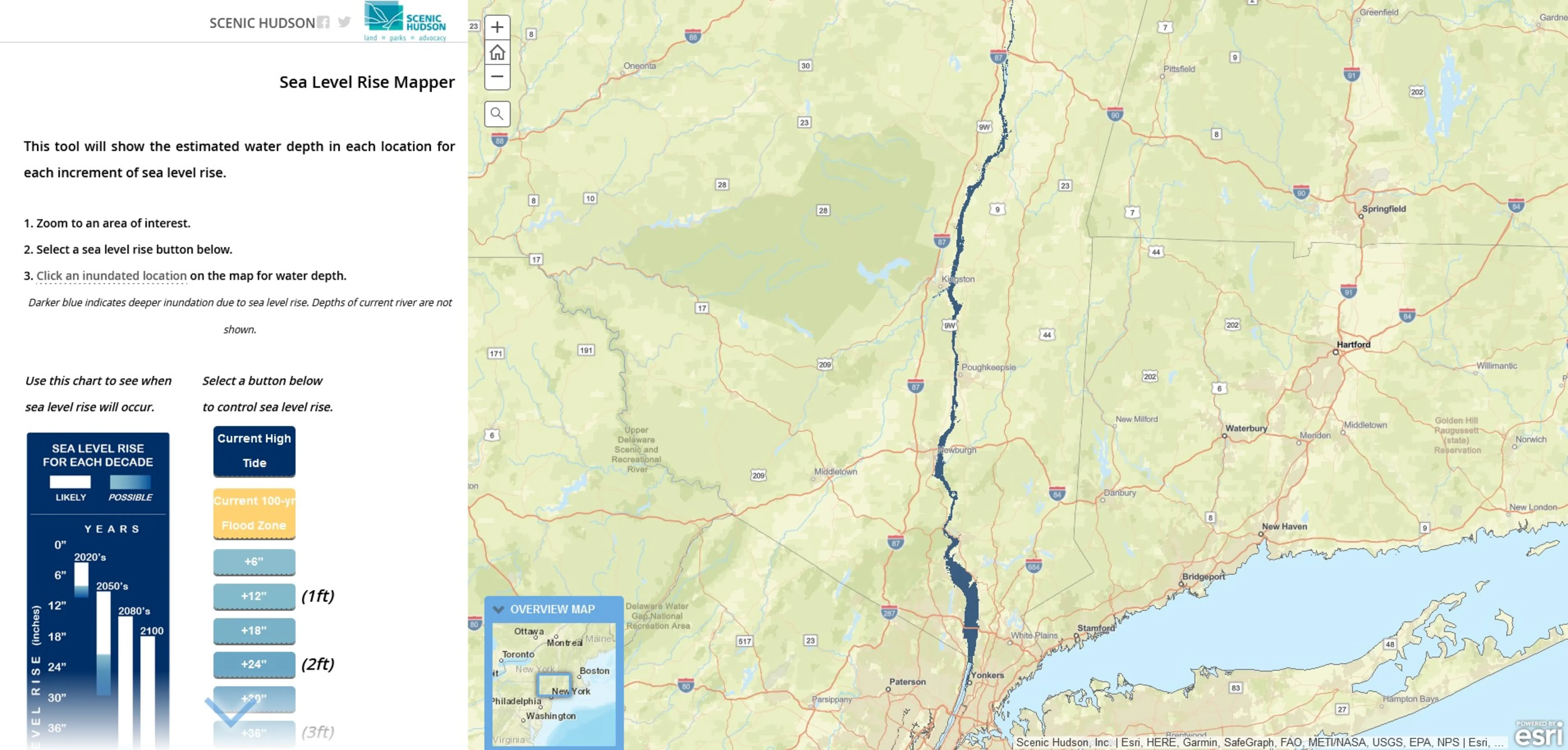
Sea Level Rise Mapper
Scenic Hudson worked with the New York State Department of Environmental Conservation, US EPA and others to compile the estuary-wide Sea Level Rise Mapper in order to further inform long-term planning discussions, as well as to its own acquisition planning efforts.

Scenic Hudson
Location: Hudson River Valley New York
Scenic Hudson was established in 1963 and has protected over 31,000 acres in nine counties, and created or enhanced many parks & preserves for public enjoyment. The organization has 50 staff, 10 specifically tasked with land trust functions.
Little Newton Hook Preserve
296 acres
Forest
Freshwater tidal wetlands
800 feet of Hudson River shoreline
Migratory waterfowl
Open to the public