Fire ready: Land stewardship amid growing wildfire risks
Source
Author

About This Saving Land
We have entered what environmental historian Stephen Pyne calls the Pyrocene, an age defined by fire, with wildfires occurring more frequently, more severely and outside traditional seasons and regions. Wildfires are striking with increasing intensity from coast to coast, devastating communities in California and surprising areas in Eastern states where major landscape fires have not been present for many decades.
Densely populated areas are particularly at risk. Nearly 90% of U.S. fires derive from human activity and, increasingly, they occur in the wildland urban interface (WUI) where forests—often struggling due to insect and disease damage—adjoin built areas. At least one-third of the U.S. population now lives in the WUI, and the number keeps rising as development sprawls. The catastrophic fires in Los Angeles this January are a tragic example of the dangers.
Marina Schauffler is an independent writer in Maine and a frequent contributor to Saving Land.
Disclaimer
These resources are provided "as is" for informational purposes only, without warranty of any kind. They do not constitute legal or professional advice and do not create an attorney-client relationship. They may not reflect current legal developments and should be adapted for your organization with qualified professional help. The Alliance is not liable for any damages arising from use of or reliance on these resources. Views in individual posts and third-party links/logos are not Alliance endorsements. The Alliance is committed to equal opportunity and does not condone unlawful discrimination.
For accreditation-related materials, please also consult the Land Trust Accreditation Commission website.
In mid-November of 2024, a fire ignited on a mountain in the heart of the Berkshires in Massachusetts, burning more than 1,600 acres of state, private and Appalachian Trail Conservancy land. It was a wake-up call for Doug Brown, director of stewardship at the accredited Berkshire Natural Resources Council.
“We had watched drought status reports ramp up to a critical level,” says Brown, as the Northeast had its driest fall on record. The organization’s field staff stopped using chainsaws to prevent sparks and began carrying fire extinguishers. But, he adds, the state’s land trust community had not yet started talking about wildfire preparedness because “it’s just so new.”
Lena Pollastro, conservation director at the accredited Land Trust of Napa County in California, recalls that sense of novelty when three local wildfires happened in 2015.
"We weren’t thinking about this as a pattern that would dramatically change stewardship,” says Pollastro. Not until a series of fires two years later burned at least half of their easement holdings did “a recognition [set in] that this was going to become much more severe and frequent.”
Since then, staff at Land Trust of Napa County have systematically revised policies, procedures and work plans—measures that helped prepare them when even more acreage burned in 2020. Now, says Pollastro, the mindset is “not if it’s going to burn, but when it’s going to burn.”
We have entered what environmental historian Stephen Pyne calls the Pyrocene, an age defined by fire, with wildfires occurring more frequently, more severely and outside traditional seasons and regions. Wildfires are striking with increasing intensity from coast to coast, devastating communities in California and surprising areas in Eastern states where major landscape fires have not been present for many decades.
Densely populated areas are particularly at risk. Nearly 90% of U.S. fires derive from human activity and, increasingly, they occur in the wildland urban interface (WUI) where forests—often struggling due to insect and disease damage—adjoin built areas. At least one-third of the U.S. population now lives in the WUI, and the number keeps rising as development sprawls. The catastrophic fires in Los Angeles this January are a tragic example of the dangers.
WUI fires can burn hotter, fueled by building materials and vehicles, and produce far more toxic material than a wildland fire, says Marilyn Black, who leads the Chemical Insights Research Institute at Underwriters Laboratories and spoke on an Alliance webinar about preparing for fire and smoke disasters. Building components and contents generate noxious emissions when burned, creating pollutants that can be absorbed through inhalation, ingestion and skin contact.
In Sonoma County, California, a setting that has experienced repeated catastrophic wildfires in recent years, “the whole county is essentially WUI—near neighborhoods, roads or vineyards,” says Joe Plaugher, stewardship project manager for the accredited Sonoma Land Trust.
“Many land trusts operate at the WUI,” says Kelly Watkinson, land and climate program director at the Land Trust Alliance. “Wildfire preparedness is increasingly a topic they need to bring into their stewardship thinking, planning and capacity.”



Managing vegetation in advance of fires
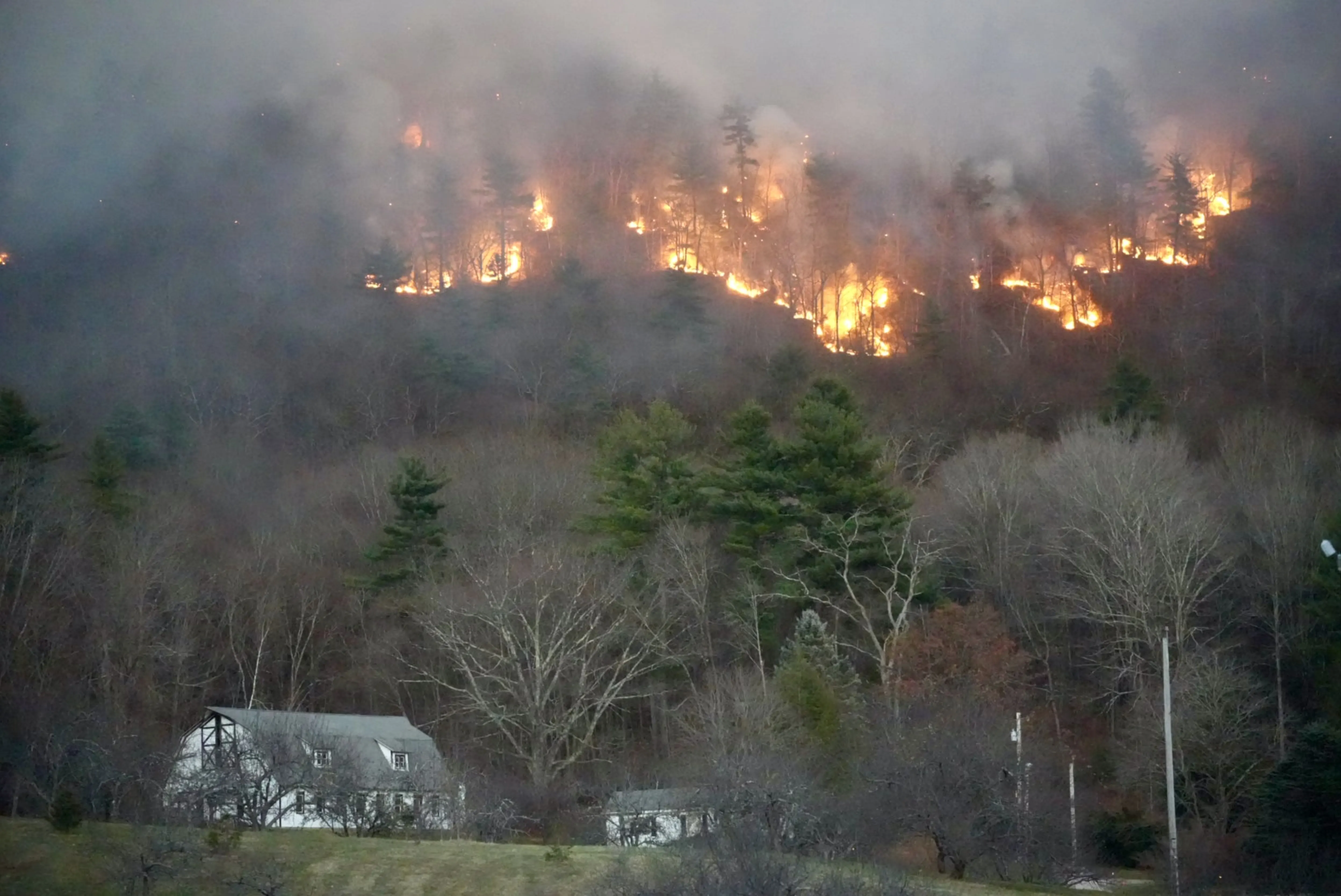
Hoping to keep fires at ground level rather than reaching into the forest canopy, land trusts have begun working with conservation easement landowners and on preserves to guide the thinning of vegetation and the removal of dead and dying trees. Some projects act as demonstration sites to educate community members about how strategic thinning can diversify tree species, enhance wildlife habitat and provide a fuel break, slowing the spread of fire.
“Vegetation management is no longer a passive activity,” Pollastro observes. Recurrent fires in Napa County have changed the land trust’s relationship with its conservation easement landowners. “In the wake of fires,” she adds, “landowner requests for personalized assistance outpaced staff capacity.” The land trust now shares wildfire preparedness and recovery information with landowners through a focused newsletter and targeted conversations during annual monitoring visits.
For millennia, Indigenous communities used controlled fires to manage ecosystems; wildland fires have only been routinely suppressed over recent centuries. Some land trusts have adopted the practice of prescribed fire—either of branch and brush piles or broadcast along the ground over many acres—to rejuvenate soils, remove shrubbery, control invasive species and reduce the load of vegetation that could ignite in a wildfire. A 2023 Stanford University study found that prescribed fire can reduce the risk of wildfire by 60%.
Long before the 2015 fires, Sonoma Land Trust began to develop prescribed burning plans, Plaugher says, but the wildfires catalyzed that process. More than 30 prescribed fire projects occurred in the county last year (not all of them on land trust properties), covering over 3,000 acres. To help oversee safe burns on preserves, he has been trained as a state-certified “burn boss,” a professional designation that reduces insurance costs for the land trust.
Conducting prescribed burns with state and local fire officials helps acquaint those personnel with conserved properties, which can be beneficial if wildfires occur because they know the location of access points and fuel breaks (cleared areas that often second as trails), notes Mary Detloff, director of public relations at the accredited Trustees of Reservations in Massachusetts. It conducts prescribed burns on eight of its most fire-prone holdings.
But land trust staff who promote prescribed burning for its ecological and public safety benefits often encounter pushback from community members fearful that even controlled burns could spread. In New Mexico, for example, public concern intensified after residents learned that the largest fire in the state’s history, the 2022 Hermit’s Peak/Calf Canyon conflagration, grew from an overlooked prescribed burn pile on national forest land.
Now efforts by the Santa Fe Conservation Trust to burn even small piles in a demonstration project have been rejected, says Melissa Houser, the organization’s stewardship director: “Fear is a powerful motivator and deterrent.” It can inspire landowners to thin vegetation on their properties, but it can also prompt adamant opposition to prescribed burns. Alternatives such as wood-chipping, she explains, can be logistically challenging on isolated properties, particularly when few contractors are available. In arid settings, anything more than a thin layer of wood chips can deter new growth or fuel fires, so chips often have to be hauled away.
Costs for large projects involving trimming and wood removal “are nearly always insurmountable” without some outside grant funding, observes David Varner, conservation manager and ecologist at Colorado West Land Trust. Sometimes land trusts can convene conservation easement landowners with adjoining properties to share costs and contractors, a partnership that can help create a more effective fuel break. In those instances, the land trust approves any plan before the contractor begins work.
It can take years to bring landowners along, and additional time to get thinning projects into the work schedules of contractors. Varner also works with conservation landowners to enhance riparian corridors and to restore wetlands, knowing that these areas serve as natural fuel breaks and can shelter wildlife during fires. Taking an ecosystem approach is essential, he says, particularly since “we’ve suppressed wildfire on the landscape for 150 years.”
Revisiting easement language, insurance coverage and safety protocols
Living and working in Napa County, where 90% of conserved lands have burned over the last decade, Pollastro says “it’s an erroneous assumption that no touch is the best touch where fire isn’t singular anymore.” Easement language dictating that properties remain “forever wild” can prove a liability concern for land trusts, she adds: “It’s a really untenable position safety- and security-wise in terms of the community.”
Since 2017, Land Trust of Napa County has revisited its easement stewardship policy and easement template (see Resources) to provide what Pollastro calls a “slightly broader lens.” Land trusts now need to consider how best to frame new easements in ways that anticipate wildfires, and how to respond to increased requests from fire management agencies for access roads and fuel breaks on conserved lands. “There’s a wide range of interpretations as to what constitutes a fuel break,” notes Bob Neale, the Alliance’s former California senior program manager.
Insurance coverage and costs for land trusts and private landowners in the most fire-prone locations are becoming a “massive problem,” Neale adds, with escalating premiums and new riders that effectively reduce coverage. Insurance constraints can limit a land trust’s capacity to even undertake a prescribed burn. Santa Fe Conservation Trust, for example, holds a $1 million policy and collaborated with a group holding a $2 million policy but still found “that doesn’t take you very far with, for example, a $6 million home adjacent to the [burn site] property,” Houser says.
Following fires, insurance payouts may prove insufficient, particularly given a doubling or tripling in local construction costs. Staff at Sonoma Land Trust, after finding its coverage inadequate, undertook planning to identify a limited set of buildings it would replace and to select fire-resistant materials and practices for rebuilding.
Another lesson derived from the 2017 fires in Sonoma and Napa counties was the importance of having a thorough emergency response plan. Sonoma Land Trust has since mapped the homes of its staff members to quickly identify which locations fall into evacuation zones. Employees use a call tree to relay emergency communications and there are contingency plans for cell service and power outages. The fire response protocol is not a static document, Plaugher says: “Annually, we refresh that and resend it to staff and board members.”
Planning should account not just for staff members’ physical safety but for the psychological trauma wildfires can inflict—with the potential for lost homes, transformed landscapes, toxic exposure, economic hardship and prolonged disruption to personal and professional lives. Reviewing personnel policies can help ensure that staff members have sufficient flexibility for personal leave and adequate mental health coverage.
Land Trust of Napa County has developed guidelines to ensure the well-being of staff and program participants—not just during active fires, but on days over 95⁰ F and those with red flag warnings or where the Air Quality Index rises over 100. When air quality remained unhealthy through an entire field season, Pollastro says staff relied on remote technology that uses aerial and satellite imagery to do annual property monitoring.
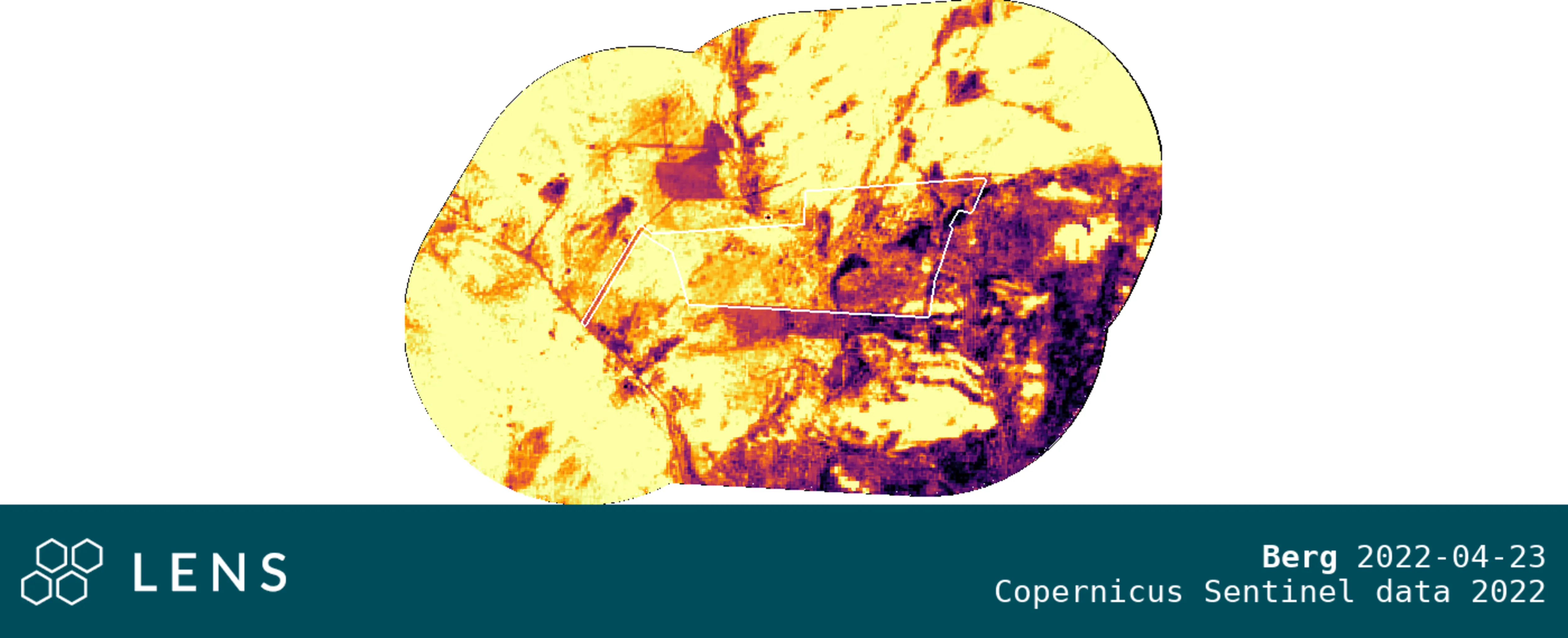
Remote imagery can be valuable for land trusts to assess newly burned properties, even indicating how hot the burn was on different portions of the land, notes Houser. The images can also identify damage from the flooding and erosion that can follow wildfires.

Partnerships foster resilience in a new era of wildfires
One of the most critical preparedness measures land trusts can take, says Sean Roome, the Alliance’s Western program coordinator, is to establish a network of regional collaborators “on the front end of a fire.” Those partnerships might include representatives of a regional fire council, state and local firefighting and emergency management agencies, water utilities, the Natural Resources Conservation Service, homeowner groups, tribal entities, watershed groups, social service agencies and contractors with the equipment and expertise to assist with projects like fuel breaks or access roads. Some groups choose to formalize their plans and roles in a written community wildfire preparedness plan.
Fire planning groups can help strengthen information-sharing, improve communication systems and limit the high cost of related equipment.
“To do the work at a scale commensurate with the problem is expensive,” Plaugher says. Participating groups in Sonoma County have benefitted from sharing equipment to support prescribed fires, including a utility task vehicle, fire pumps, a fire brush truck, hoses and an excavator. (More modest investments that many land trusts can make include water bladders, fire landscape rakes and N95 masks.)
Among natural disasters, wildfire has always been anomalous in “our thinking we can stop it,” Plaugher observes. As the recent Los Angeles fires demonstrated, WUI fires in extreme conditions can now exceed the limits of suppression techniques. Communities need to start “coming to terms with fire being a natural process,” he adds, which fundamentally changes our relationship with it. “You can accept and [often] manage it, but you can’t reject it.”
Early this year, the Alliance’s Western Program hosted the first listening session of a nascent Wildfire Resilience Network, bringing together roughly two dozen land trust staff members to share ideas.
“Multiple conversations made clear the need for a peer-to-peer network for learning and sharing about how land trusts can help their communities improve their wildfire resiliency,” says Neale.
Houser is eager for this shared learning, hoping to find “what they know that we don’t know.” She’d like to learn from those that have undergone proximate fires: “What are the top 10 things they wished they had planned for?”
Some written guidance and informal sharing exists, but the new group will offer opportunities for dialogue, skill-building and potentially even “elements of mentorship,” Roome says. It could help more trusts take preventive measures, ensure safety during fire events, and better navigate the aftermath and recovery.
The Wildfire Resilience Network may serve as a pilot for other Alliance initiatives, with similar models adopted in other regions or even for “natural disasters writ large, so that land trusts are part of the solution,” Neale says. Much of the planning and preparedness work applies across many forms of climate-driven disruptions (and disasters increasingly arrive in pairs, like fires followed by landslides).
Knowing that wildfires will keep happening, Pollastro says, the operative question becomes: “Have we done what we can to reduce the severity of it on our conservation lands?”
Marina Schauffler is an independent writer in Maine and a frequent contributor to Saving Land.
