New River Land Trust uses birds to more deeply connect with landowners
Birds appeal to so many people through their colorful plumage and interesting vocalizations; they can inspire connections with nature and can help landowners get excited about conservation.
Through its collaboration and partnership with the Land Trust Alliance, the Cornell Lab of Ornithology is connecting with and supporting land trusts in their efforts to protect bird habitat on private lands and for birds to help support land trust planning and stewardship efforts. We're happy to share their bird conservation success stories from land trust partners across the country.
[*Editor’s Note: This article follows the American Ornithological Society's recommendation that all bird names are capitalized to prevent confusion between taxonomic and descriptive words.]
The whole business of land conservation is based on the willingness and excitement of landowners, said Grayson Davie, conservation coordinator at New River Land Trust in the Catawba Valley of Virginia. He notes that connecting on a personal basis with landowners and finding out what they are passionate about is the key to success.
Birds appeal to so many people through their colorful plumage and interesting vocalizations; they can inspire connections with nature and can help landowners get excited about conservation. Thus, as part of a Land Trust Bird Conservation Initiative small grant project in 2023, the land trust set out to understand bird species occurrence on two large farm properties protected by conservation easements in an effort to build relationships with the landowners.
Through the grant, New River Land Trust volunteers surveyed birds on the properties during the breeding season. Staff then compared the bird data collected by their volunteers to the data available through the Northeast Bird Habitat Conservation Initiative (NBHCI) Mapping Tool, an interactive decision support tool that displays modeled eBird Status and Trends data in 13 states for 43 bird species.
After comparing the NBHCI Mapping Tool data with bird observation data collected in the field, New River Land Trust found good alignment between the two data sources and feels comfortable referring to NBHCI data and pointing landowners to it, said Davie.
“We now have another set of data that we can use to get people interested in conservation and land protection,” he said.
In the past, New River’s conservation value assessments, which are used to prioritize land protection and acquisition projects, have not included bird data; now, the land trust is making bird data part of their prioritization process and including it in conversations with landowners.
Spotlight Resources: eBird, NBHCI Mapping Tool, Volunteers, Partnerships
Over the course of this project, to collect bird data in the field, New River Land Trust staff conducted 26 site visits with staff from Appalachian Mountains Joint Venture, a co-applicant on this grant, and seven volunteers from the Virginia Tech Bird Club and Blacksburg High School. Bird monitoring was conducted along 350-foot transects on working farms during the breeding season and fall migration period, and data was recorded using eBird, the online checklist program.
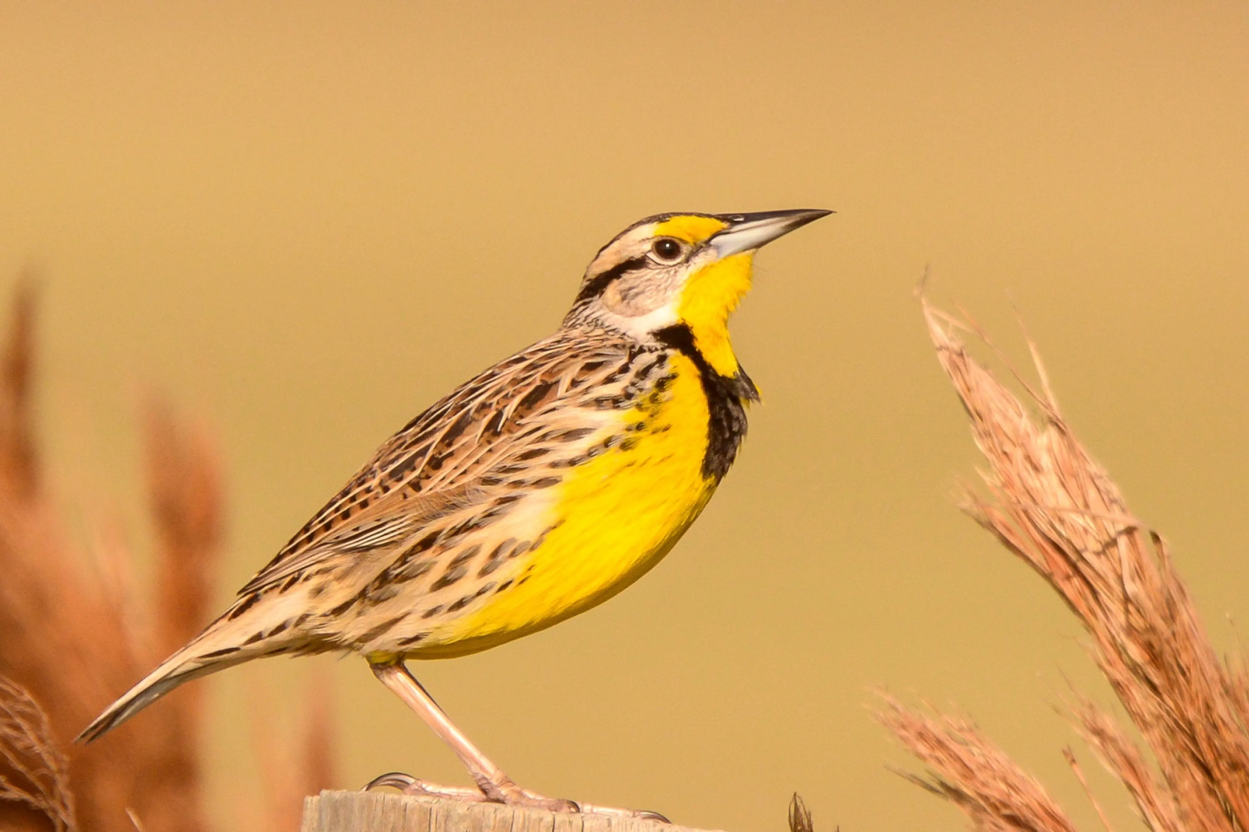
The study was designed by Becky Keller, the science coordinator at Appalachian Mountain Joint Venture. During monitoring visits, 87 bird species were observed, including common grassland birds like Eastern Bluebird, Song Sparrow and Red-winged Blackbird — and some species in decline and listed as Species of Greatest Conservation Need in Virginia’s State Wildlife Action Plan, such as Eastern Meadowlark and Grasshopper Sparrow.
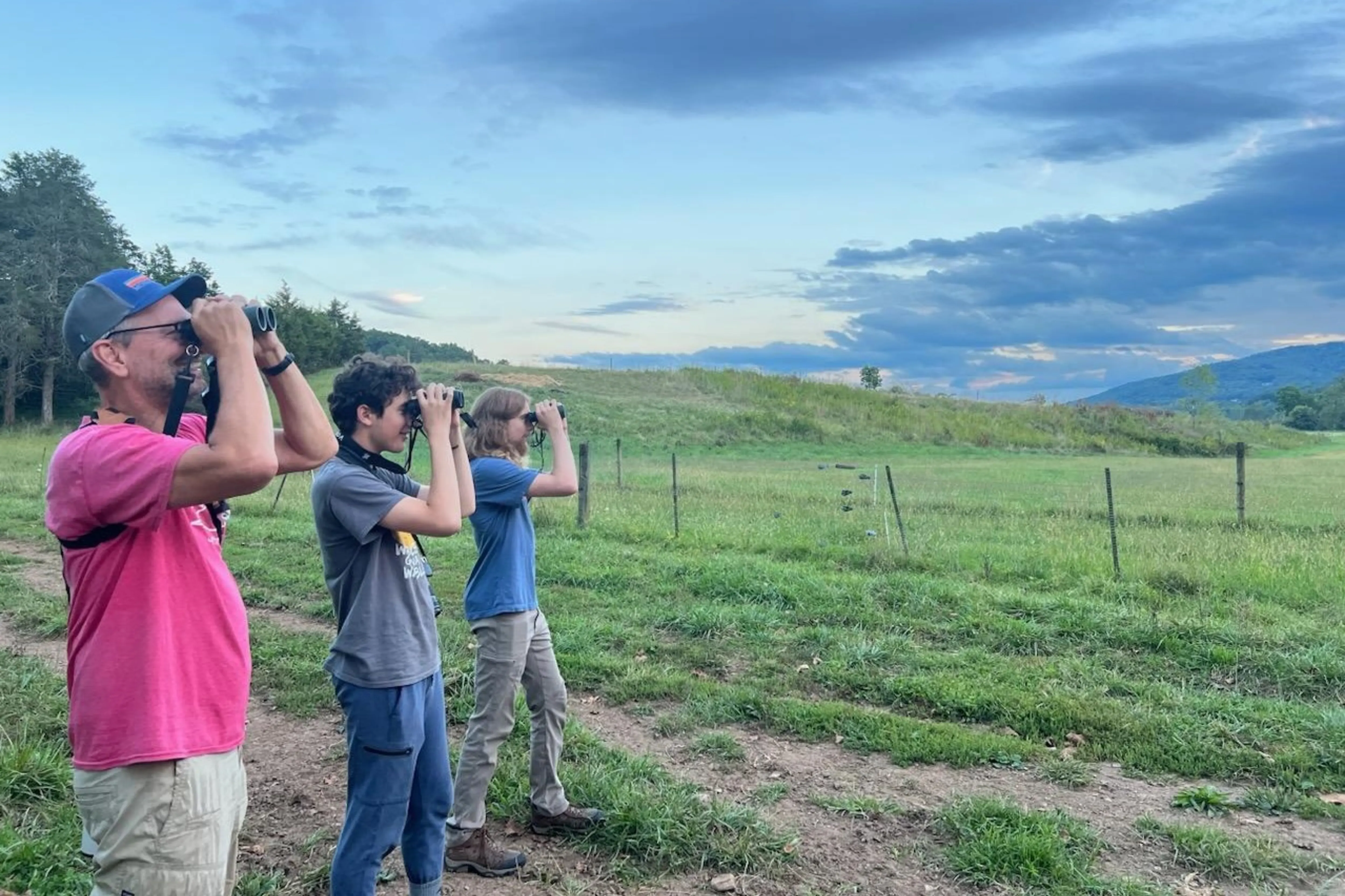
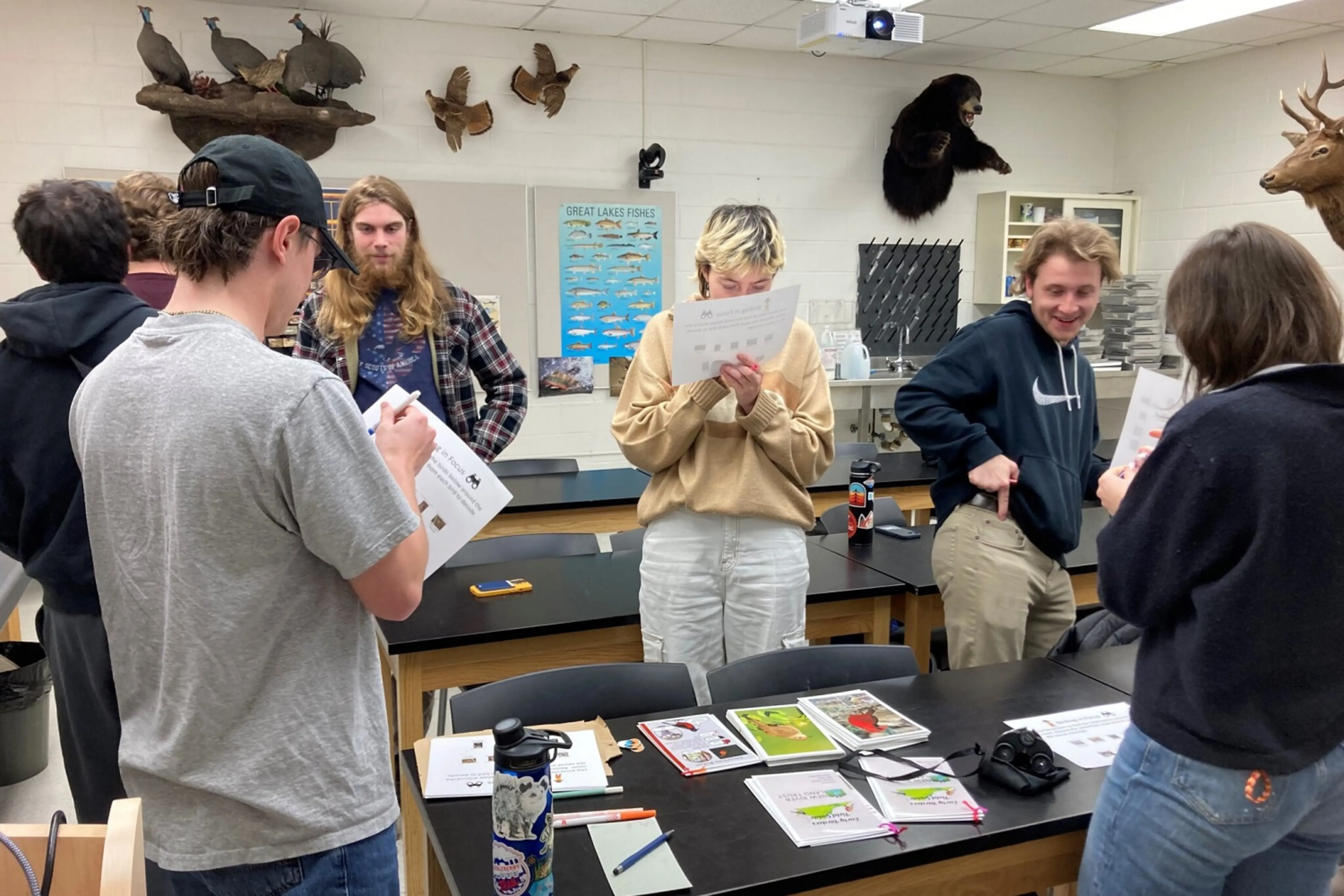
Before bird surveys were conducted, New River Land Trust hosted three days of eBird training for the volunteers to make sure they were comfortable identifying bird species by sight and sound; volunteers also learned to enter data correctly in the eBird app to ensure its use in future scientific research and bird conservation measures, including analyses of bird population changes over time.
“Our volunteers were the meat of this study,” noted Davie, who was pleasantly surprised by how robust the data was and what a fantastic job volunteers had done collecting it. “This project was successful because we had so much good data.”
Davie manipulated the collected data to calculate relative abundance for observed species, comparing New River Land Trust’s data to the modeled eBird abundance data available through the NBHCI Mapping Tool. Overall, the data collected on the ground verified the data predicted by the Mapping Tool, giving land trust staff the confidence to use the tool to estimate bird species and abundance on properties of future conservation interest and to talk with landowners about the importance of protecting bird habitats.
Making the connection
While data collection and analysis were the focus of this project, the relationships built with volunteers were the foundation of its success. By working with local schools, birding clubs and a bird conservation partner, New River engaged local volunteers for 80 hours, recording more than 1,700 individual birds and building capacity to complete project activities.
This work aligned partners with different skill sets who supported one another to meet project goals. Becky Keller, from Appalachian Mountain Joint Venture, was responsible for the study design and monitoring protocol training; Davie, who is not a birder but a GIS technician, managed the data, analyses and mapping; and Bethany Bookout, former Youth Outreach Coordinator at New River Land Trust, was responsible for coordinating and communicating with volunteers, which Davie said was critical to the success of this project.
Advice to other land trusts
Davie suggested that other land trusts in the Northeast experiment with the NBHCI Mapping Tool to become familiar with bird data in their service areas. The tool can provide insight into target bird species present on private lands to help with land prioritization, and this information can be especially interesting to landowners who are exploring the idea of protecting their land and want to become an active part of a conservation story.
Davie said that landowners often want to know what kinds of birds are on their property and how they can help improve the habitat for these species, making a difference through actions on their land no matter how big or small. Bird data can open doors to these conversations and get landowners interested in conservation.
“If there is a certain target bird on their property, now we can tell them about the bird and the science behind it and get them excited about their part in its conservation story,” said Davie.
Next steps
New River Land Trust produced outreach materials to educate landowners about the bird species found during their surveys, and they plan to create more bird-specific outreach materials with interns in the future. In the meantime, the land trust is closing more easements than ever before and hearing from more people wanting to get involved in land conservation in the area, thanks in part to the birds.
As those conversations progress, New River Land Trust will be integrating bird data from the NBHCI Mapping Tool into the outreach process. As Davie said, “We’re hoping it will be one more thing that will help convince people to protect their land.”
The views, thoughts and opinions expressed in this blog are the author's own and do not necessarily reflect the views of the Land Trust Alliance, its staff, its board of directors or any other individuals associated with the organization.